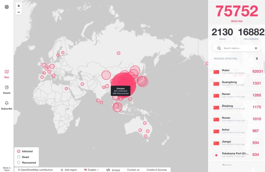
Above: The coronavirus mapping website.
Kevin Basset and Maxime Michel are French expatriates living in Taiwan who decided to create a web app to track the spread of the coronavirus.
Basset works in the country as a VP of Marketing in the 3D simulation field and Michel is a marketing specialist.
Realising how seriously the spread of the virus was being taken, with almost everyone wearing masks to take public transport.
At Michel’s office, masks are worn all day, in-person meetings are avoided if necessary and nobody eats in the same office.
In creating the web app, they first thought of putting the information about the spread of the coronavirus into the hands of their friends and colleagues, but then realised that, as he puts it, “The rest of the world might be interested.”
The web app pulls data, according to Basset, from “several official sources such as [the] WHO but also local health department in concerned regions.”
A complete list of current sources is part of the website, which is continuously updated with new information that users can use to drill down into the specific profile of infection in any major city or region.
The two men have produced the project with no plan for monetisation.


It was already created by Johns Hopkins CSSE about 3 weeks ago, Kevin Basset and Maxime Michel just copied it. https://gisanddata.maps.arcgis.com/apps/opsdashboard/index.html#/bda7594740fd40299423467b48e9ecf6